GLandMeasure: A Free App for Measuring Areas and Lengths
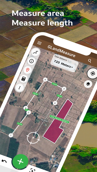
GLandMeasure is a free iPhone app designed for measuring areas and lengths. It offers a convenient solution for various purposes such as measuring land, farms, fields, and homes. The app provides two methods of measurement - pinning on the map or using the actual walking method. By simply pinning points on the map, GLandMeasure automatically calculates the area and length.
One of the standout features of GLandMeasure is its ability to export coordinates in various formats, including land sales announcements, PDF, Excel, KML, Geojson, map photos, route finder, elevation, soil cue calculations, tree counts in the area, weather forecasts, calculations, and cameras. This makes it a versatile tool for professionals in real estate and agriculture.
GLandMeasure also offers support for various tools such as a compass tool, measurement unit converter, coordinate unit converter (GEO, UTM, MGRS), Geojson geographic camera, and multiple layers including WMS, XYZ Tiles, Image Layers, and Current Rain Layers. The app also supports the creation of multiple projects and can handle large amounts of data efficiently.
Overall, GLandMeasure is a user-friendly and feature-rich app that provides accurate measurements for various purposes. It is a valuable tool for professionals and individuals alike.